Three Ways High-resolution Aerial Imagery Facilitates Due Diligence

Aerial imaging technology enables commercial real estate professionals to research properties much more quickly and easily than in the past.
LIKE MOST CLICHES, “a photograph is worth a thousand words” is true. But when that photograph is taken from an aerial vantage point, the image also could easily be worth millions of dollars. When it comes to the real estate industry, the right collection of images can make or break a deal.
According to MLS statistics, homes featuring aerial imagery in their listings sell 68 percent faster than those with standard images. New advances in high-resolution aerial imagery now allow commercial real estate brokers to incorporate those detailed images into much-improved property maps.
Those enhanced maps are effectively changing how commercial brokers sell undeveloped swaths of property and existing retail complexes. Commercial real estate transactions and projects have been significantly altered as a result of these improved aerial images in three distinct ways. These range from convenience features like touring properties in the comfort of an office or easily accessing images stored in the cloud to identifying vital details like traffic patterns and changes in a location over time.
Tour Properties From Your Office
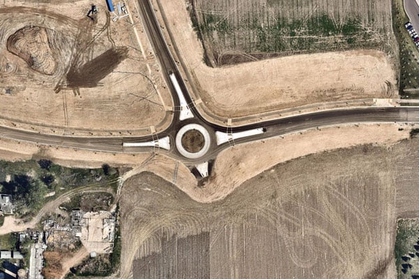
With high-resolution imagery, real estate professionals can now access a great deal of information about a particular commercial space. Terrain, proximity to neighboring properties, boundary assessments, road development, even roof condition can all now be viewed from an aerial perspective.
High-resolution aerial imagery like that provided by Nearmap, with a quality better than 3-inch ground sample distance (GSD), captures precise images much clearer than satellite imagery. Clients can tour dozens of properties without leaving their broker’s office, saving hours of valuable time.
Essentially, property tours that once took multiple hours, most of which was spent traveling to and from the destination, are now completed in about 60 minutes. Brokers and clients can quickly assess a property and determine within minutes if it is a viable location worthy of an on-site visit.
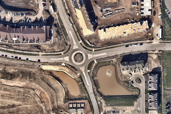
Nearmap high-resolution photographs can provide birds-eye views of construction sites, like this Minneapolis hotel site, shown in May 2016 and October 2017.
GIS and CAD Integration
The CRE industry relies heavily on geographic information system (GIS) and computer-aided design (CAD) technology. Mapping professionals aim to accurately create and illustrate property maps that capture everything from an area’s overall demographics, property measurements and competitive market analysis to smaller details like street names, signage, traffic patterns and more.
Those mapping professionals know that high-quality aerial imagery is a necessity. By using images captured by Nearmap and layered into their systems using GIS and CAD integration tools like ArcMap, AutoCAD and others, brokers are able to provide the most up-to-date, crystal-clear mapping imagery for their clients.
Improved Site Evaluation
Better than a bird’s eye view, GIS maps, especially when overlaid with high-resolution aerial imagery, allow property developers complete visual access to a property. Coupling those maps with aerial imagery that is captured every six months also enables brokers and developers to assess a property’s history. Brokers and their clients can view the landscape in leaf-off and leaf-on seasons and monitor, validate and compare changes to the property over time.
Using enhanced GIS maps, a developer looking to purchase a plot of land for a large shopping center, for example, can identify ideal entrance and exit points, measure acreage or distance to the nearest competitor, view sight lines and even determine optimal locations for signage.
Gone are the times when brokers and their clients spent long, travel-filled days physically touring sprawling commercial properties. Today, easily accessible GIS aerial maps overlaid with high-resolution imagery allow for comfortable in-office property tours while also providing tools for accurate measurements and seasonal changes, delivered within days and streamed through the cloud to their smartphones or tablets.
By Gregg Katz, director of innovation and technology, The Shopping Center Group, gregg.katz@tscg.com